Oddball 2022 hurricane season finally comes to an end

Florida was impacted by three systems during the 2022 hurricane season. (Image credit: NOAA/ Wikimedia Commons)

Today marks the end of the 2022 hurricane season, one that Florida will not soon forget.

At a glance, the Atlantic had an average season with 14 named storms, eight hurricanes and two majors. But in fact it was a wild and rocky ride with lots of early-season predictions of a long parade of storms, a puzzling mid-season lull, and late-season destruction.

The season’s Accumulated Cyclone Energy (ACE) was below normal for the first time in six seasons.

Since it was a La Niña summer, most forecasters were bullish about the number of storms and hurricanes in the Atlantic due to anticipated favorable wind shear and unusually warm ocean water. Instead the summer defied expectations, in large part due to dry air, a persistent flow of dusty Saharan air that lowered humidity levels in the basin.

“While La Niña typically decreases tropical Atlantic and Caribbean vertical wind shear, wind shear was elevated across the Caribbean in both August and October,” Colorado State University hurricane researcher Philip Klotzbach said in an end-of-season analysis issued Monday. “The complete lack of activity in August 2022 was the biggest surprise of the 2022 season.”

Preseason predictions were more off the mark than usual. On May 24, NOAA’s initial forecast called for 14-21 named storms, six to 10 hurricanes and three to six majors. The agency’s August updated forecast was only slightly paired back, in part because we had no tropical activity at all from July 2 to September 1.

Colorado State University, widely reported by the media, was more on the mark with its December 9, 2021 forecast of 13-16 storms than it was in the April forecast of 19 named storms.

In the end, the blue ribbon goes to the University of Arizona, which predicted on April 14 that the Atlantic would see 14 named storms, seven hurricanes and three majors. The university’s accuracy will not go unmentioned next April, but with so many shifting variables due to climate change, preseason forecasts may be less reliable in the future as nature pursues its complex twists and turns.

Florida’s coasts were under the gun three times with what eventually became Tropical Storm Alex in early June, Huricane Ian in late September, and Hurricane Nichole during the second week of November.

Hurricane Ian was hands-down the most costly and deadly storm of the season, pounding Cuba and following that up with a brutal hit to Florida’s southwest coast. It caused more than $50 billion worth of damage and killed at least 157 people, unleashing its destructive forces far into Central Florida and the east coast.

Ian will go into the books as a strong Category 4 with sustained winds of 155 mph, unless the National Hurricane Center does some reanalysis off season (as it did with Andrew in 1992) and determines that it did in fact cross that Category 5 threshold.

Just a week earlier, Hurricane Fiona pounded the Caribbean causing at least $2.88 in damage and 31 deaths. It devastated Puerto Rico, dropping almost 3 feet of rain in some areas and triggering massive flooding.

Ian caused similar misery in Florida, dropping a foot of rain in Orlando and as much as 2 feet in and around New Smyrna Beach on the east coast.

Ian was the fifth-deadliest hurricane to hit the U.S. since 1963, according to Yale Climate Connections.

What made things worse with Ian is that the track became unpredictable. Forecasters seemed to have settled on a track into Florida north of, or around Tampa, but Ian instead took a southern route into the Fort Myers area, a track that had been predicted earlier by the European forecast model.

NHC forecasters had indeed emphasized the uncertainty in Ian’s track.

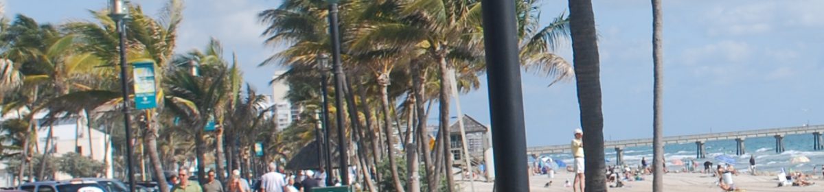
In November, Hurricane Nichole hit Grand Bahama and made landfall near Vero Beach as a Category 1. Probably its biggest impact was beach erosion on Florida’s east coast.

Eroded beach continues to be a problem as we head into the Christmas season, even far to the south of where Nichole made landfall.

What will 2023 look like? It’s anybody’s guess. We might assume that another La Niña summer is unlikely, so maybe we’ll finally catch a break.

But as forecasters say — and as we found out again this season — all it takes is one destructive landfall to make it a bad season.

Unusually warm start to December seen for Florida, forecasters say

December is now expected to begin on a warm note in Florida and much of the East Coast. (Image credit: NOAA/ CPC)

MORE RECORD HIGHS: Miami scored a record high for the second day in a row Saturday with 87, beating the previous record of 86 set in 1979.

Sanford reported a low Saturday with 69, which tied a record warm low set in 1978.

“Temperatures may approach record highs this afternoon for some locations,” the National Weather Service in Miami said Sunday, “with highs in the upper 80s and heat indices measuring in the lower 90s.”

After a weakening cold front moves through early Monday morning, South Florida highs should be knocked back into the low 80s, forecasters said. Another front may impact the peninsula later in the week that should keep temps at “seasonably warm” levels, they said.

*

SATURDAY UPDATE: Miami broke a 75-year-old high temperature record Friday with 88. The old record of 86 was set on November 25, 1947.

It was 87 in West Palm Beach, 85 in Fort Lauderdale and Naples. The West Palm temperature was just a degree off the record of 88 set in 1947.

In the Keys, Marathon tied a record high with 87, matching the mark set for the date in 1957.

In east-central Florida, Vero Beach tied a 1983 record with 87.

*

HOLIDAY WEEKEND WEATHER: It was a warm Turkey Day and the forecast is for to get even warmer. A cold front is forecast to push down the peninsula Sunday, but it runs out of gas, stalls, and high pressure from the south builds in behind it.

“Overall front-related impacts from this system will be limited for South Florida,” says the National Weather Service in Miami. Into early next week, “anomalously warm temperatures will remain over South Florida.” Highs should stick around in the mid-80s.

The Climate Prediction Center is now indicating above normal temps throughout the state during the first week of December, with normal precipitation but below normal rainfall in northwestern Florida.

After a near-washout to begin Thanksgiving week, it looks like we’re going to be sliding into a very toasty pattern to kick off the holiday season.

Even Tampa and Orlando should make it up to near 80 for at least the next week or so with the cooler weather confined to north Florida.

*

RAINFALL RAINFALL REPORT: It was a pretty nice Thanksgiving with only a few spits of rain here and there. However, a CoCoRaHS observer reported 1.14 inches in East Naples and almost half an inch — 0.43 — fell in Hollywood.

In Central Florida, an observer reported 1.05 inches in St. Cloud, and a few hundredths of an inch fell along the Treasure Coast.

In the northwest panhandle, Century, Florida reported 0.73 of an inch.

*

TROPICS WATCH: the National Hurricane Center says no tropical cyclones are expected over the next five days, which would bring us to the official end of the hurricane season with 14 named storms, eight hurricanes and two majors.

That’s a pretty normal season, except that we went through some normally high intensity periods without a storm this simmer while fall has been hectic.

There is one fly in the forecast ointment, however, and that’s that the GFS is suggesting that an early December storm may develop out in the Atlantic late next weekend and then push east toward the Bahamas.

The model had been showing development at the end of its runs off and on recently in the Caribbean but has abandoned that in favor of this new scenario, which has a tropical storm nearing the Bahamas from the east a week from next Wednesday.

It’s not supported by the other models so it’s probably just the GFS doing its GFS thing.

Florida cold snap has panhandle temps in 20s; warmth returns to peninsula next week

Forecast rainfall totals in South Florida through Monday morning. (Image credit: NWS-Miami)

Brrrr! Actual fall weather has arrived in Florida. (But not for long.)

It was in the low- to mid-60s on the southeastern coast Friday morning, the upper 50s on the west coast, and the low 50s north of Lake Okeechobee.

It was near 50 in the Orlando area and the low- to mid-40s on the Nature Coast, with mid- to upper-30s in North Florida and the Tallahassee area. But it was in the upper 20s to low 30s in the western panhandle and in Crestview, northeast of Pensacola it was a downright cold 24 degrees.

The National Weather Service has settled on the Sunday through Tuesday time frame for a possible heavy rain scenario for the southern and central peninsula as the cold front stalled out in the Florida Straits comes back north as a warm front.

Forecasters in Miami are predicting up to 2 inches of rain through Monday morning in northeastern Palm Beach County; up to 1.5 in coastal Broward and Miami-Dade.

As a result, Wednesday and Thanksgivng Day look pretty decent in South Florida with mostly sunny skies and highs back in the low- to mid-80s. It may take an extra day for the skies to clear out in central Florida, but Thanksgiving should be pretty nice.

Before we look at the tropical weather, I thought we could shuffle off to Buffalo for a moment to see how the multi-day snow storm is progressing. According to the NWS, some spots in Erie County have received around 2 feet as of Friday morning while areas of Chautauqua County have received a foot.

The lake effect snow is forecast to continue into Sunday, with accumulations of another couple of feet or so, but highs may creep back up into the 40s next week so at least the snow plows should have a chance to catch up.

*

FOR ENTERTAINMENT PURPOSES ONLY: The GFS keeps trying to spin up a tropical storm or hurricane in the Caribbean over the last couple of days of November and the start of December. For example, the 06Z Friday run has a 987mb low south of western Cuba in two weeks.

Other models don’t go out that far and the GFS has had a reputation for spinning up “ghost storms” that never materialize.

Still, 2022 has been an odd-duck year so I wouldn’t write off any scenario. Late-season storms are usually swept off to the east; the GFS has this one meandering as it weakens.

Cold holiday week shaping up for most of U.S., but Florida to maintain toasty temps

A cold Thanksgiving week may be in the cards for the central U.S. Florida may be warm but wet, according to long-range forecasts. (Image credit: NOAA/ CPC)

SUNDAY UPDATE: West Palm Beach picked up another 0.70 of an inch of rain Saturday, bringing the monthly total to an impressive (for November) 3.77 inches, 2.18 above average for this point in the month.

Most of that was the 2.25 inches from Nicole on Wednesday, but it would be good to see a wetter month after a very dry October and overall dry summer.

Miami received only 0.02 of an inch Saturday, but is still ahead of the game for November, while Fort Lauderdale had 0.31 of an inch and is up more than 4 inches for the month.

A CoCoRaHS observer in the western Palm Beach County community of Golden Lakes reported 1.30 inches and an observer in western Boynton Beach reported 1.04 inches. To the south, South Miami reported 0.65 and Marathon reported 0.69.

On the shore of Lake Okeechobee, Moore Haven reported 0.60 of an inch, with mostly dry conditions in Central and North Florida.

The trigger was a cold front that was pushng down the peninsula but was losing its punch rapidly, and by the time it gets into the southern peninsula it will have been wrung out like a wash cloth. That’s my interpretation from the National Weather Service forecast discussion.

Another front makes a run at South Florida Tuesday but stalls around Lake Okeechobee. A third front late in the week could bring some decent rains to the southern peninsula. It all adds up to what NOAA’s Climate Prediction Center has been advertising for the past several days — a generally wet end to November.

Weather Underground is predicting several days of rain Thanksgiving week, and AccuWeather predicts a wet Thanksgiving Eve and mostly cloudy weather for Turkey Day itself, but no cold temps.

*

SATURDAY POST: The cold fronts are coming! The cold fronts are coming!

A series of frontal boundaries will make a run at central and south Florida starting Sunday and into the upcoming week, according to the National Weather Service. Unfortunately none of them look to have enough punch to sweep all the way into South Florida and deliver some pre-holiday crispness.

Forecasters in Miami are using terms like “decaying” and “whithering” and — at best — “lingering” rather than a clean sweep, and South Florida temps are actually expected to remain above average through the longer-term period.

Normal highs and lows in Miami this time of the year are 82 and 69; 80 and 67 in West Palm Beach, which is pretty nice weather. But apparently highs and lows will be closer to the mid-80s and 70, at least along the coast, which ain’t all that bad either.

But Orlando could actually see some late fall/ winter-type temps late next week: Thursday’s forecast high is only 72 with a low of 56, which is darn near parka weather and at the very least sweater weather. Miami’s forecast high and low for the same day: 81 and 73.

Gainesville is expected to top out Thursday at 65 with a low of 45, which is a little cold even for the alligators in Lake Alice.

Thanksgiving Day is a little far out for the local forecasts, but the Climate Prediction Center is forecasting an unusually cold holiday week for the central U.S., with much-below temperatures in the Great Lakes States and below normal temps all the way south to the Gulf Coast.

In fact, the GFS on Friday was predicting some snow for the Great Lakes.

The exceptions to the cold snap will be South and Central Florida, as well as coastal Oregon and Washington.

*

(Image credit: NHC)

TROPICS WATCH: One other bit of cleanup from departing Hurricane/ Tropical Storm Nicole: Gainesville had a record strong wind gust Friday, 35 mph. That broke the previous record gust for November 11 of 32 mph set in 2020.

Tropical development is not expected over the next five days, the National Hurricane Center says. Nor, hopefully, for at least the next 200 days, which is the start of the 2023 hurricane season.

Who knows what that might look like — it’s hard enough to forecast a storm when it’s forming or when it’s tracking across the Atlantic. But it’s a fair bet (obviously not a done deal) that we won’t have a La Niña next summer, and we might even be lucky enough to transition to an El Niño, which would (could) slow down Atlantic tropical storm traffic.

The season officially ends on November 30.

Weather Service: ‘imperative’ to focus on tropical forecast; threat to east coast growing

Forecast for low pressure system near Puerto Rico. Invest 97L is in the north-central Atlantic. (Image credit: NHC)

SUNDAY TROPICS WATCH: Concern was rising Sunday at the National Weather Service offices in Florida as the developing low nearing the Bahamas appeared to take aim at the state’s east coast — and possibly plow through the interior after that.

Some of the major forecast models were coming into some sort of general agreement on Sunday that mid- to late-week could be problematic for the peninsula, but forecasters stressed the great amount of uncertainty with the intensity forecast.

The National Hurricane Center put development chances — whatever forms could be tropical or subtropical — at 70-90 percent from Tuesday through Friday. The disturbance was designated Invest 98L Sunday morning.

Forecast tracks for Invest 98L. (Image credit: SFWMD)

Weather Service forecasters have had some good analyses in their forecast discussions, although I would hazard a guess that many people — there are already a lot of visitors in Florida and seasonal residents have begun to arrive — aren’t focused on the possibility of preparing for severe weather.

NWS Melbourne:

“Though a reasonable amount of uncertainty remains in the forecast from this period forward, models are coming to similar solutions that warrant serious attention from mid to late week. By sunrise Wednesday, a strong subtropical or tropical system will be picking up speed and some intensity as it moves southwestward toward the northern Bahamas.

“The first outer rain bands may send gusty squalls to the Treasure Coast Wednesday morning, followed by an expansion to the Space Coast in the afternoon. Coincidentally, WPC QPF quickly increases across east central Florida, especially east of Orlando. The next jog the system looks to take is one to the northwest, and timing this is a challenge.

“Models suggest a turn to the west-northwest Wednesday afternoon and evening with the low ejecting out of the Bahamas toward the Florida east coast early Thursday morning.

“EURO model guidance is faster, taking a more southward trajectory. The GFS lies in the middle of the guidance envelope with the system crossing the Florida Peninsula, from the Treasure Coast and up the spine of the Peninsula. The 00z Canadian is the slowest of the mentioned three, with the low center approaching the Space Coast Thursday afternoon as it turns northward, paralleling the Florida east coast.

“All that said, any one of these solutions will be impactful to east central Florida in the form of wind, rainfall, and dangerous beach/marine conditions. Depending on the low strength and track, significant rainfall and increased flooding concerns may also unfold.

“With the understanding that many people are still dealing with the devastating effects of Hurricane Ian, this makes it even more imperative that attention be paid to the latest forecast for development and progression of this system through next week.”

(Image credit: NWS-Miami)

The NWS in Miami: “What we do know: A low-pressure system will begin to deepen just West of the Bahamas as high pressure builds across the Southeast United States. This building high pressure will have the tendency to send the area of low pressure westward towards the Florida peninsula, although exactly what this system will look like is still not well understood.”

“Details will be better understood over the coming days.”

NWS Key West: “A ridge of high pressure north of the potential system will push the subtropical or tropical cyclone to the west, possibly near the east coast of Florida.

“I want to emphasize there is still high uncertainty in the track and intensity of the low pressure system or tropical cyclone. What we do know is rain chances will increase from (30-40%) Tuesday through the end of the week. At this time, the best rain chances will be on Wednesday and Thursday. The potential tropical or subtropical cyclone could cause elevated winds and tides in the Keys.”

*

CALLING TIME: Did you remember to set your clocks back? Of course you did. Here are some of the new sunset times in Florida:

Miami, 5:32 p.m.; Orlando, 5:36 p.m.; Tampa, 5:42 p.m.; Jacksonville, 5:35 p.m.; Tallahassee, 5:45 p.m.; Pensacola, 4:57 p.m. (Central Standard Time).

Hurricane Center predicts heavy rain, coastal flooding and beach erosion for Florida East Coast

The National Hurricane Center upped five-day development chances for the low near the Bahamas to 80 percent Saturday night. Forecasters gave it 50 percent development chances by Monday. (Image credit: NHC)

TROPICS WATCH: The GFS has certainly caused its share of hand wringing in Florida over the last couple of days. It has been showing, with no great consistency, various forecasts with tropical storms and even hurricanes impacting the peninsula.

Other forecast models are onboard with some type of development for the broad system being monitored by the National Hurricane Center over the Bahamas and the northeastern Caribbean. But what ultimately happens was still up in the air as the weekend arrived.

The Saturday morning run of the GFS depicted a weaker low coming out of the Bahamas on Tuesday, clipping the southern tip of the peninsula on Thursday and then powering up in the Gulf of Mexico on Friday before hooking back into the peninsula north of Tampa on Saturday as a hurricane.

Earlier iterations were more unkind to Florida’s East Coast.

The European (ECMWF) has been more subdued, with a very weak system poking around the peninsula toward the end of next week, while the Canadian (CMC) has moved north to the Carolinas, following the NAVGEM. The German ICON plows a weak storm into Florida’s East Coast next Thursday.

The NHC is predicting that whatever develops could be tropical or subtropical and adds in its Saturday analysis: “Regardless of development, there is an increasing risk of coastal flooding, gale-force winds, heavy rainfall, rough surf, and beach erosion along much of the southeastern United States coast, the Florida east coast, and portions of the central and northwestern Bahamas during the early to middle part of next week.”

It was given a 20-60 percent chance of development from Monday into Thursday.

National Weather Service Miami: “Model solutions continue to differ regarding the potential for some sort of sub-tropical or even tropical system in the Atlantic waters early-to-mid week. Regardless of the evolution of this system, models are in tight agreement about some sort of low-pressure system developing across the western Atlantic waters which at the very least, will create some considerable marine and coastal hazards for Southeast Florida.”

NWS Melbourne: “An increasingly unsettled weather pattern with considerable forecasting challenges will unfold late weekend into next week. A good deal of uncertainty remains with regard to the evolution of a low pressure system over the southwestern Atlantic and its approach to the Florida east coast mid week. However, confidence is increasing in the potential for coastal flooding, beach erosion, heavy rainfall, gusty winds, and rough surf as we head into the next work week.”

Flooding next week may be aggravated by king tides, NWS forecasters in Key West noted.

You don’t think of tropical storms or hurricanes impacting the Florida peninsula in November, but it does happen. A couple of storms come to mind.

One was the 1994 Hurricane Gordon, which formed on November 8, 1994 and caused mayhem for two weeks thereafter. It spun up in the southwestern Caribbean, sailed across eastern Cuba and then hung a sharp left turn and went through the Keys.

It then made landfall in southwestern Florida near Fort Myers on November 16, exited in Vero Beach into the Atlantic, went northeast to near the Carolinas coast and then made an abrupt U-turn, making yet another landfall near Cape Canaveral on November 20.

Track for Hurricane Kate in 1985. (Image credit: NOAA)

Hurricane Kate formed in an area similar to the one now being watched by the NHC on November 15, 1985. It quickly intensified and became a hurricane the next day, moving south of the Keys into the Gulf of Mexico. Winds muscled up to 125 mph at one point, making it a major.

It made landfall near Mexico Beach on November 21 with winds of 100 mph.

The Yankee Hurricane hit Miami on November 4, 1935 as a Category 2. It was another one of those rare weather events in which the storm spun up from an extratropical system near Bermuda.

Record highs in Tampa, Fort Myers; Florida watching western Atlantic

(Image credit: NHC)

FRIDAY UPDATE: The Hurricane Center upped development chances for the system expected to form near the Bahamas this weekend to 40 percent. But there was still no forecast model consensus on where it might go, or how strong or weak it might be.

“Model solutions continue to differ on the evolution of this system and small changes in the development of this system can lead to changes in local impacts,” The National Weather Service in Miami said.

Obviously, the pattern should become more clear as the weekend progresses. As of Friday morning, NOAA’s Weather Prediction Center has the heaviest rain next week focused on the northeastern coast of Florida.

The Weather Prediction Center graphical forecast for the next seven days showed heaviest totals on Florida’s northeast coast. (Image credit: NOAA/ WPC)

*

THURSDAY POST: Lisa was barely hanging on to tropical storm strength after slamming Belize Wednesday and was expected to dissipate in the southern Gulf of Mexico. Martin was forecast to become extra-tropical on a tortuous route to northern Scotland on Monday.

In Florida, eyes have shifted to the western Atlantic, where a low pressure system is forecast to develop over the weekend and then merge with another low to its north. The National Hurricane Center says conditions could be favorable for some tropical or subtropical development as it moves north or northwest.

Forecasters are giving the system a 30 percent chance of development.

The Thursday morning run of the GFS has the weak low spinning up in the Bahamas late on Sunday or Monday, then continuing west into the Florida peninsula on Tuesday. It then meanders around the Florida peninsula for the rest of the week.

The European model echoes this scenario but a little weaker. The Canadian (CMC) is a little stronger but moves it more to the north, toward the Carolinas.

The only model with any punch is the NAVGEM, which pulls it into South Carolina on Wednesday. The ICON keeps it hanging around in the southern Bahamas, weak.

The National Weather Service in Miami is expecting no rain in South Florida through Sunday morning. NOAA’s Weather Prediction Centr is calling for most of the heaviest rain to remain offshore through next Thursday.

The National Weather Service in Melbourne said in its Thursday forecast discussion: “Operational and ensemble guidance point to a continued unsettled pattern, resulting in hazardous boating and surf conditions into the middle and latter part of next week. Ridging over the central and eastern Gulf of Mexico looks to completely break down.

“With high pressure building across the western Gulf/Lower Mississippi Valley, this will allow a path for the aforementioned area of sub-tropical/tropical low pressure to swing westward on Tuesday and Wednesday. Rain chances go up some more as a result, especially east of Interstate 95. Windy conditions are forecast with embedded gusty squalls possible Tuesday into the first part of Wednesday.

“By Wednesday into Thursday, the broad area of low pressure looks to drift westward over the east-central Gulf before becoming influenced by an approaching trough over the central CONUS. At the end of the seven day period, the trough appears to weaken and lift the sub-tropical Gulf low northeastward across the Florida Peninsula.”

*

RECORD WATCH: Tampa set a new record high Wednesday with 90, busting the old record of 89 set in 1972. Fort Myers set another new record high with 92. In the Keys, Marathon broke a record high with 90.

The low in Miami Wednesday was 79, which broke a record warm low of 78 set just three years ago in 2019. Fort Lauderdale also broke a record warm low with 79.

Orlando tied a record warm low at 73,

*

DROUGHT WATCH: Severe and Moderate Drought (D-1 and D-2) spread in the Florida panhandle this week. The entire panhandle is now in severe or moderate drought east into the Big Bend area.

Hurricane Lisa spins toward Belize; temperature records fall on Florida peninsula, Keys

(Image credit: NHC)

TROPICS WATCH: Hurricane Lisa was headed toward landfall in Belize later today, and Martin, also approaching hurricane strength, was heading northeast to Nowhere Land. Lisa reached Category 1 status at 8 a.m. Wednesday with winds of 75 mph.

The main feature to watch in Florida was the low expected to form near the Bahamas over the next few days — models are a bit spread out on it, but the NHC says there could be some tropical or subtropical development as it heads north and northwest. Forecasters gave it a 20 percent chance of development by Monday.

The GFS, European (ECMWF) and Canadian (CMC) had a very weak system approaching northeastern Florida next week. But these models keep shifting around and forecasters are continuing to wait for some kind of consensus.

National Weather Service Miami: “As this area of low pressure gradually develops, the pressure gradient will continue to tighten over the area allowing for breezy conditions to continue through the early portion of the week. With this being towards the end of the forecast period along with model disagreement in placement and intensity of the area of low pressure, uncertainty remains high during this time frame.

“The latest forecast takes a blend of the forecast models and increases the chances of showers and thunderstorms later in the weekend and into the early portion of next week. This will continue to be monitored as the week progresses.”

NWS forecasters in Melbourne said “the vertically stacked, deep layer low expected to retrograde westward across the Bahamas and near or across Florida (depending on which op-model one favors) through the middle of next week.

“In spite of the model differences and extended range time frame, strong agreement/continuity in the model guidance suggests above normal confidence for deteriorating weather conditions (breezy to windy conditions with showers/squalls) especially near the coast, as well as increasingly hazardous sea/surf conditions developing.

“The National Hurricane Center continues to monitor this area for potential (sub)tropical cyclone development by early next week.”

*

RECORD WATCH: Leesburg set a record high Tuesday with 90, breading the old record of 89 set way back in 1968. It tied the all-time record high temperature for November of 90, set on November 6, 2015.

The National Weather Service office for Tampa in Rufkin reached 91, busting the old record of 90 set in 2015. It was 92 in Fort Myers, busting a 43-year-old record of 91 set in 1979.

Marathon tied a record high with 90. That matched the mark set in 2002.

Miami tied a record warm low with 79, and Fort Lauderdale busted a record warm low with 80, beating the old record of 79 set in 2015. West Palm tied a 40-year-old record warm low with 78.

*

DRY OCTOBER ON WEST COAST: Actually the entire peninsula was dry last month, but Chiefland had its second-driest October on record with just 0.02 of an inch of rain, the NWS in Tampa reported. Normal rainfall for October is 3.17 inches.

St. Petersburg had its sixth-driest October with 0.23 of an inch of rain (normal is 2.16) and Punta Gorda had its seventh-driest with 0.33 (3.02 normal).

Lisa strengthening in Caribbean; Martin forms in north Atlantic

NOVEMBER … OR SEPTEMBER? Hard to tell jus looking at this busy Tropical Weather Outlook map from the National Hurricane Center. Forecasters were watching three areas in the Atlantic on Tuesday afternoon, including the newly minted Tropical Storm Martin in the north-central Atlantic. For only the third time since satellite coverage began in 1966, there were two named storms simultaneously in the Atlantic within the month of November, said Colorado State University hurricane researcher Philip Klotzbach. The other two years were 2001 and 2020. Lisa had strengthened to a 60 mph storm in the Caribbean and was headed for landfall Wednesday night as a hurricane in Belize. Martin was also forecast to become a hurricane Wednesday, but was not expected to affect land. Meanwhile, the NHC said a low pressure system was expected to develop east of the Bahamas over the next several days, and forecasters gave it a 20 percent chance of becoming a depression, or Tropical Storm Nicole, by late this weekend. (Image credit: NHC)

*

It’s November, so let’s talk turkey.

It’s been a tough year weather wise for some folks, with a record heat over the peninsula, the wreckage that Hurricane Ian brought and drought that keeps building and expanding from the panhandle down into North Florida.

Now the seasonal people begin streaming back looking for warmer temps while the locals keep hoping for a breath or two of cool air.

October was overall cooler than average but it certainly didn’t go out that way.

West Palm Beach tied a record warm low on Monday with 78 after a steamy high of 87. The heat index topped out at 95. It was 88 in Miami with a heat index of 96.

Fort Myers tied a 103-year-old record high with 91, it was 90 in Orlando for only the second time in October; 89 in Tampa.

And as that famous duo from the Sixties said, the heat goes on, with 90s expected in South Florida’s interior; upper 80s in the Central Florida interior. Big rainfall deficits are starting to dry up the landscape up and down the peninsula and it doesn’t look like there will be any relief in the coming days.

The big question is whether that continues next week as some unsettled weather potentially moves in from the Atlantic. NOAA’s Climate Prediction Center has next week pegged for above normal precip on the peninsula’s East Coast, although the new forecast for November is overall warm and dry.

(Image credit: NOAA/ CPC)

Forecast models can’t agree on what happens with the messy weather around the Bahamas so we won’t have a clearer picture of rain potential until the weekend.

National Weather Service, Melbourne: “Both the GFS/ECMWF have large cyclonic gyre aloft retrograding slowly W/NW closer to FL, but vary in overall strength and speed. Below this feature an area of low pressure takes shape at the surface but exact location varies significantly either near or NE of the Bahamas, and is stronger in the 00Z GFS compared to the 00Z ECMWF.

“This will certainly be something to watch closely to see how this pattern evolves in future model runs, but currently it still remains a low confidence forecast beyond the weekend due to the diverging model solutions and lack of
consistency from run to run.”

NWS Key West: “Heading into the later part of the week, a significant pattern change is in store, as mid latitude energy cuts off over the Carolinas then dives southward, with a large tropical gyre developing over the eastern Bahamas by the weekend. It appears that we will initially see a drier and slightly cooler airmass with NE flow on the western side of this feature, and rain chances drop to just 10 percent for Friday through Saturday, with
dewpoints expected to ease down into the upper 60s to near 70.

“Uncertainty increases considerably thereafter, with a general model consensus that the gyre will drift slowly northwest toward Florida late in the weekend and into the following week. This could eventually bring a wet early November interlude to the Keys, but it is still too early to have much confidence at this point.”

*

LISA, MARTIN, AND NICOLE: Sounds like an old trio of folk singers. But Nicole is a tropical storm in the Caribbean with designs on becoming a hurricane by Wednesday before it slams into Belize. An area of disturbed weather in the north-central Atlantic had a 70 percent chance of becoming the next depression — or Tropical or Subtropical Storm Martin later today or Wednesday.

That leaves Nicole, which I bring up because if the season should somehow be able to squeeze out one more storm after Martin it would go into the books as a normal hurricane season with 14 named storms.

TS Lisa a potential hurricane in Caribbean; ‘large tropical gyre’ forecast to form near Bahamas

Tropical Storm Lisa formed Monday in the Caribbean. Forecasters predicted it would become a hurricane before making landfall in Belize on Wednesday. (Image credit: NHC)

HALLOWEEN TROPICS WATCH: The big scary monster that the GFS was predicting in the Caribbean hasn’t come to pass — yet.

Potential Tropical Cyclone 15 was struggling Monday in the central Caribbean with winds of 40 mph — strong enough to be classified as a tropical storm — but the convection was light and disorganized.

Nevertheless, the National Hurricane Center said it would likely become Tropical Storm Lisa later today, and top out as an 80 mph hurricane before it smacks into Belize on Wednesday or Thursday.

The GFS is showing some messy business developing near and east of the Bahamas next weekend, but the National Weather Service in Miami is calling it a mid- to upper-level low that will keep South Florida dry with northeasterly winds.

However, some of the forecast models have been showing this area eventually shifting west toward Florida.

The National Weather Service in Key West describes it as a “large tropical gyre” in the Monday morning forecast discussion: “Heading into the later part of the week, a significant pattern change is in store, as mid latitude energy cuts off over the Carolinas then dives southward, with a large tropical gyre developing over the eastern Bahamas by the weekend.

“It appears that we will initially see a drier and slightly cooler airmass with NE flow on the western side of this feature, and have removed rain chances from the forecast for Friday through Saturday, with dewpoints expected to ease down into the upper 60s to near 70.

“Uncertainty increases considerably thereafter, with a general model consensus that the gyre will drift slowly westward toward the Keys late in the weekend and into the following week. This could eventually bring a wet early November interlude to the Keys, but it is still too early to have any confidence at this point.”

NWS Melbourne: “While there are some slight differences in the models into late week through the weekend, there remains fairly strong agreement in overall pattern between the GFS and ECMWF. Large mid/upper level cut-off low east of FL on Friday settles southward across the eastern Bahamas/Turks and Caicos region into this weekend before retrograding westward late weekend into early next week.

“At the surface, a strong western Atlantic high pressure north of the area extends westwards, with a breezy/windy onshore flow developing and largely prevailing through the period.

“Low level moisture gradually increases and combined with the strengthening east-northeast flow, should at least lead to isolated showers over the Atlantic that area able to push onshore each day. Increasing shower coverage and the potential for some thunderstorm development by late weekend into early next week is then expected as moisture continues to increase and closed low aloft draws nearer.

“Rain chances are conservative at the moment with PoPs around 20 percent along the east coast through Fri-Sun, increasing to 20-30 percent across east central FL on Monday. However, should this pattern hold in the model guidance, would likely see these values rise, especially from Saturday onward.”

A wet early November may be quite welcome, since October was unusually dry and we’re headed into another dry winter with La Niña in charge once again in the Pacific.

Miami is finishing the month with a rainfall deficit of 2.64 inches; Fort Lauderdale is down 2.45 inches and West Palm Beach is looking at a significant deficit of 3.10 inches.

In Central Florida, Orlando is down 1.25 inches and Melbourne is coming up 2.88 inches short. Vero Beach has a deficit of 3.17 and Fort Pierce, 3.02. Conditions would be even more dire in Fort Pierce were it not for the 0.52 of an inch that fell over the weekend.

WEATHER HISTORY: Key West is down 2.76 inches in October. The island has had lots of tropical weather in its storied history and the NWS reports that in 1933, Key West recorded 23.56 inches in October, its wettest ever.

The driest October occurred in 1972, when only 0.74 of an inch fell all month.