Why weather matters … and a few end notes

With the 2022 hurricane season under our belt, I am putting Florida Weather Watch on the shelf, at least for the time being. It’s a blog that has been baked into my daily routine starting in 2009, when I launched Weather Matters for the Palm Beach Daily News.

As a journalist, I’ve covered a lot of different beats, focusing primarily on health care. Weather was an interesting challenge, having grown up in a Midwestern climate that had two basic kinds of weather: summer, and misery mode.

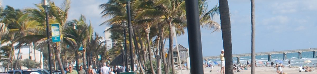
A lot of people think Florida doesn’t have seasons, just one “endless summer” with a few temperature and humidity dips in the winter. Or two seasons — tourist and off-season.

Both of these viewpoints are incorrect. Not only does Florida have four seasons, but the state is composed of a series of complex micro-climates that support different types of weather, gardens and landscaping.

A garden on the southeastern coast, for example, is going to look different from one in central Florida and especially the panhandle. The Keys are in a categroy all their own, a true tropical climate even though the islands don’t quite poke below the Tropic of Cancer, just north of Cuba.

We are heading into the winter season now and for many people, this is what it’s all about. The low humidity, generally dry days in the 70s and cool nights in the 50s in central Florida, 60s in the south. I think they relish it because this is closest to what many have enjoyed “back home” in the summer.

My favorite time of the year, though, is February through May. February is the beginning of our real spring in the southern and central peniinsula, when many plants start budding out anew. Citrus trees bloom, and some of my best road trips over the past decades have been driving from West Palm to the University of Florida in Gainesville for the first Gators baseball game on back highways, rolling the car windows down so I can be enveloped by the fragrance.

Spring in Florida is accompanied by a gradual warm-up. Because we’re surrounded by water the change from winter to spring is slow and subtle, and if you’re on the coast you can get a fresh breeze all the way into June even though the sun is hot.

Compare this to other climates at the mercy of continental cold fronts or warm fronts that give you weather in the 30s one day, the 80s the next, and 40s the next. Our local meteorolgist used to call spring fronts pneumonia fronts.

Sure, hurricane season is a hair in the Florida climate soup. But there are really only three months to worry about — August, September and October. Florida was hit by Category 1 Nicole this November, but that was an anomaly, and not likely to become a fixture of our fall weather patterns.

And how do you prepare for an Ian, an Irma, or an Andrew? You button up the best you can, pay close attention to what the local officials and the National Hurricane Center are telling you, and cross your fingers. You pays your money and takes your chances.

The biggest problem with hurricanes is people assume it probably won’t be as bad as forecasters/ media/ pubic officials say. Because often times that’s the case … but not always. If you continually underestimate, the next time a real one is on top of you it will be too late to do anything about it.

You’d be better off to over-prepare for 20 “dud” hurricanes than to be caught once off-guard, having taken it too lightly.

What to do about summer? It can be an uncomfortable time of the year from Key West all the way up to Pensacola, but it has its own charms. Think of lighter traffic, more elbow room at bars and restaurants, and mango season.

Sometimes it’s tough to stay hyrdated if you like to excercise outside in the summer, but think of coming home after a long bike ride and pulling a cold, freshly ripe mango out of the fridge and tearing through it over the kitchen sink.

I guess that’s something you’ll never see in the tourist brochures but it’s one of our many sub-tropical summer delights, along with plunging into pleasantly cool ocean surf during a hot day at the beach.

Speaking of which, maybe I’ll see you there.

Florida’s November: unusually warm and wet

DECEMBER OUTLOOK: NOAA released its December forecast and, no surprises, it calls for above normal temperatures throughout Florida and below normal precipitation. This is pretty much right in line with a La Niña winter — generally warm and dry in Florida. (Image credit: NOAA)

November was unusually wet and warm across the Florida peninsula. We still haven’t had any super-strong cold fronts, and Hurricane Nichole helped jack up rainfall totals throughout the state.

Miami was 4.1 degrees above normal for the month with 8.49 inches of rain — 4.96 over normal.

Fort Lauderdale came in 3.2 degrees above average with a precipitation surplus of 4.86; West Palm Beach was 4.4 above average with a precip surplus of 2.48 inches; and Naples came in 4.6 degrees above average with a smaller 1.06-inch rainfall surplus.

In Central Florida, Orlando was also 4.6 degrees above average and 4.27 inches above the precipitation normal.

Fort Pierce had the highest November temperature anomaly on the peninsula at 4.8 degrees above average. The city had 5.77 inches of rain, 2.76 above normal.

In Tampa, “the rainfall from Nicole in many areas was more in one day then we usually see during the entire month of November,” the National Weather Service in Tampa said in a monthly climate report.

Tampa had 5.18 inches of rain in November, 3.78 above average. The city was 2.8 degrees warmer than normal in November.

Note that today is also the first day of meteorological winter, which runs from December 1 through February 28.

RECORD WATCH: Fort Lauderdale posted a record warm low Wednesday with 74 degrees, tying a record for the date in 2001.

Oddball 2022 hurricane season finally comes to an end

Florida was impacted by three systems during the 2022 hurricane season. (Image credit: NOAA/ Wikimedia Commons)

Today marks the end of the 2022 hurricane season, one that Florida will not soon forget.

At a glance, the Atlantic had an average season with 14 named storms, eight hurricanes and two majors. But in fact it was a wild and rocky ride with lots of early-season predictions of a long parade of storms, a puzzling mid-season lull, and late-season destruction.

The season’s Accumulated Cyclone Energy (ACE) was below normal for the first time in six seasons.

Since it was a La Niña summer, most forecasters were bullish about the number of storms and hurricanes in the Atlantic due to anticipated favorable wind shear and unusually warm ocean water. Instead the summer defied expectations, in large part due to dry air, a persistent flow of dusty Saharan air that lowered humidity levels in the basin.

“While La Niña typically decreases tropical Atlantic and Caribbean vertical wind shear, wind shear was elevated across the Caribbean in both August and October,” Colorado State University hurricane researcher Philip Klotzbach said in an end-of-season analysis issued Monday. “The complete lack of activity in August 2022 was the biggest surprise of the 2022 season.”

Preseason predictions were more off the mark than usual. On May 24, NOAA’s initial forecast called for 14-21 named storms, six to 10 hurricanes and three to six majors. The agency’s August updated forecast was only slightly paired back, in part because we had no tropical activity at all from July 2 to September 1.

Colorado State University, widely reported by the media, was more on the mark with its December 9, 2021 forecast of 13-16 storms than it was in the April forecast of 19 named storms.

In the end, the blue ribbon goes to the University of Arizona, which predicted on April 14 that the Atlantic would see 14 named storms, seven hurricanes and three majors. The university’s accuracy will not go unmentioned next April, but with so many shifting variables due to climate change, preseason forecasts may be less reliable in the future as nature pursues its complex twists and turns.

Florida’s coasts were under the gun three times with what eventually became Tropical Storm Alex in early June, Huricane Ian in late September, and Hurricane Nichole during the second week of November.

Hurricane Ian was hands-down the most costly and deadly storm of the season, pounding Cuba and following that up with a brutal hit to Florida’s southwest coast. It caused more than $50 billion worth of damage and killed at least 157 people, unleashing its destructive forces far into Central Florida and the east coast.

Ian will go into the books as a strong Category 4 with sustained winds of 155 mph, unless the National Hurricane Center does some reanalysis off season (as it did with Andrew in 1992) and determines that it did in fact cross that Category 5 threshold.

Just a week earlier, Hurricane Fiona pounded the Caribbean causing at least $2.88 in damage and 31 deaths. It devastated Puerto Rico, dropping almost 3 feet of rain in some areas and triggering massive flooding.

Ian caused similar misery in Florida, dropping a foot of rain in Orlando and as much as 2 feet in and around New Smyrna Beach on the east coast.

Ian was the fifth-deadliest hurricane to hit the U.S. since 1963, according to Yale Climate Connections.

What made things worse with Ian is that the track became unpredictable. Forecasters seemed to have settled on a track into Florida north of, or around Tampa, but Ian instead took a southern route into the Fort Myers area, a track that had been predicted earlier by the European forecast model.

NHC forecasters had indeed emphasized the uncertainty in Ian’s track.

In November, Hurricane Nichole hit Grand Bahama and made landfall near Vero Beach as a Category 1. Probably its biggest impact was beach erosion on Florida’s east coast.

Eroded beach continues to be a problem as we head into the Christmas season, even far to the south of where Nichole made landfall.

What will 2023 look like? It’s anybody’s guess. We might assume that another La Niña summer is unlikely, so maybe we’ll finally catch a break.

But as forecasters say — and as we found out again this season — all it takes is one destructive landfall to make it a bad season.

More Florida temp records fall; cold front brings some relief

The new long-range forecast issued Sunday predicts more above-normal temperatures in Florida into mid-December. (Image credit: NOAA/ CPC)

The last day of the holiday weekend was also the last day of the mini-heat wave that has baked South Florida since the departure of the stalled (and rainy) front last week.

Miami had another record high Sunday with 89, beating the old record for the date of 87 set way back in 1940. It was the third straight record high set in Miami over the weekend.

Fort Lauderdale tied a record high with 88, equalling the record set in 1948, and Marathon set a record high with 87.

On the Treasure Coast, Vero Beach scored a record high with 87, beating the old record of 86 set in 1967; and Fort Pierce tied a record high with 86 while Leesburg tied a record with 84.

Orlando busted a record warm low Sunday with 71, beating the old record of 70 set in 1942. And it was 72 in Melbourne for a low, breaking the old mark of 71 set in 2011.

The cold front that pushed down the peninsula Sunday night and Monday morning is set to cool things off, but not a lot. Forecast highs in South Florida are still in the low 80s this week; the 70s in Central Florida.

The front dropped around a quarter of an inch in the Tampa area with a few wetter spots, including 0.65 of an inch in Wesley Chapel, Pasco County.

*

OTHER WORLDLY WEATHER: Scientists have released the forecast for WASP-39 b — partly cloudy with a chance of chance of sulphur dioxide.

The planet orbits a star 700 light years away from Earth, a long haul even for the Starship Enterprise, but the James Webb Space Telescope discovered “a full menu of atoms, molecules, and even signs of active chemistry and clouds,” according to researchers at the Center for Astrophysics/ Harvard and Smithsonian.

Data show how the clouds look up close: broken up, not a single blanket of clouds over the planet. The results are good news for scientists who want details about the atmospheres of other far away worlds.

“We observed the exoplanet with multiple instruments that, together, provide a broad swath of the infrared spectrum and a panoply of chemical fingerprints inaccessible until JWST,” said Natalie Batalha, an astronomer at the University of California, Santa Cruz, who contributed to the research. “Data like these are a game changer.”

Not that WASP-39 b is a place you’d want to settle down. It’s a hot, Saturn-like outpost with an atmosphere made up of mostly of hydrogen, but sulfure dioxide was also detected along with sodium, potassium and water vapor.

At an average temperature of 1,600 degrees Fahrenheit, WASP-39 b is even hotter than Florida.

It is not thought to be habitable but the analysis offers hope that those that are habitable can be likewise depicted in detail.

“I am looking forward to seeing what we find in the atmospheres of small, terrestrial planets,” says astronomer Mercedes López-Morales.

Unusually warm start to December seen for Florida, forecasters say

December is now expected to begin on a warm note in Florida and much of the East Coast. (Image credit: NOAA/ CPC)

MORE RECORD HIGHS: Miami scored a record high for the second day in a row Saturday with 87, beating the previous record of 86 set in 1979.

Sanford reported a low Saturday with 69, which tied a record warm low set in 1978.

“Temperatures may approach record highs this afternoon for some locations,” the National Weather Service in Miami said Sunday, “with highs in the upper 80s and heat indices measuring in the lower 90s.”

After a weakening cold front moves through early Monday morning, South Florida highs should be knocked back into the low 80s, forecasters said. Another front may impact the peninsula later in the week that should keep temps at “seasonably warm” levels, they said.

*

SATURDAY UPDATE: Miami broke a 75-year-old high temperature record Friday with 88. The old record of 86 was set on November 25, 1947.

It was 87 in West Palm Beach, 85 in Fort Lauderdale and Naples. The West Palm temperature was just a degree off the record of 88 set in 1947.

In the Keys, Marathon tied a record high with 87, matching the mark set for the date in 1957.

In east-central Florida, Vero Beach tied a 1983 record with 87.

*

HOLIDAY WEEKEND WEATHER: It was a warm Turkey Day and the forecast is for to get even warmer. A cold front is forecast to push down the peninsula Sunday, but it runs out of gas, stalls, and high pressure from the south builds in behind it.

“Overall front-related impacts from this system will be limited for South Florida,” says the National Weather Service in Miami. Into early next week, “anomalously warm temperatures will remain over South Florida.” Highs should stick around in the mid-80s.

The Climate Prediction Center is now indicating above normal temps throughout the state during the first week of December, with normal precipitation but below normal rainfall in northwestern Florida.

After a near-washout to begin Thanksgiving week, it looks like we’re going to be sliding into a very toasty pattern to kick off the holiday season.

Even Tampa and Orlando should make it up to near 80 for at least the next week or so with the cooler weather confined to north Florida.

*

RAINFALL RAINFALL REPORT: It was a pretty nice Thanksgiving with only a few spits of rain here and there. However, a CoCoRaHS observer reported 1.14 inches in East Naples and almost half an inch — 0.43 — fell in Hollywood.

In Central Florida, an observer reported 1.05 inches in St. Cloud, and a few hundredths of an inch fell along the Treasure Coast.

In the northwest panhandle, Century, Florida reported 0.73 of an inch.

*

TROPICS WATCH: the National Hurricane Center says no tropical cyclones are expected over the next five days, which would bring us to the official end of the hurricane season with 14 named storms, eight hurricanes and two majors.

That’s a pretty normal season, except that we went through some normally high intensity periods without a storm this simmer while fall has been hectic.

There is one fly in the forecast ointment, however, and that’s that the GFS is suggesting that an early December storm may develop out in the Atlantic late next weekend and then push east toward the Bahamas.

The model had been showing development at the end of its runs off and on recently in the Caribbean but has abandoned that in favor of this new scenario, which has a tropical storm nearing the Bahamas from the east a week from next Wednesday.

It’s not supported by the other models so it’s probably just the GFS doing its GFS thing.

Florida’s blustery November weather: ‘The end is finally in sight’

Wednesday started out with dense fog in the south and central Florida interior that was expected to burn off by mid-morning. (Image credit: NWS-Melbourne)

WEDNESDAY UPDATE: Big weather news today. (Or should we call it breaking weather news? No, that whole thing is pretty worn out, isn’t it?)

  1. This weekend’s cold front has been cancelled, for all practical purposes — at least for South Florida. Central Florida will see some cool-down, but no biggie.
  2. This messy, cloudy, wet weather (with the occasional off-season downpour) that we’ve been dealing with since Sunday is finally getting ready to buzz-off.

“Day 4 of the unsettled pattern,” National Weather Service forecasters in Melbourne said Wednesday, “and the end is finally in sight … Hires models have the trough getting finally kicked to the northeast this afternoon, while global models are slower and keep it in the neighborhood until later in the evening. It may be wish-casting, but as of 4 AM radar imagery looks to be showing the strongest convection starting to shift eastward.”

“… drier air arrives (though we`ll have to wait tomorrow before we really see the sun again).”

And on this weekend’s cold front from the NWS-Miami:

“The latest model guidance continues to indicate that the frontal boundary will be weakening as it approaches and moves through southern FL on Sunday,” National Weather Service forecasters in Miami said in their Wednesday forecast discussion.

“With the impeding dry air and low precipitable water, the frontal boundary does not look like it will have enough moisture to work with as it passes, keeping all rain showers to our north. After some indecisive model runs, temperatures are trending towards the warmer side, through the weekend, with little impact from the front on Sunday.”

Thanksgiving Day forecasts show rather nice holiday weather with all the trimmings:

  • Miami, mostly sunny with a high of 82.
  • West Palm Beach, mostly sunny, high of 79.
  • Orlando, partly sunny, high of 81 with a 20 percent chance of a shower after noon.
  • Tampa, mostly sunny with a high of 82.
  • Jacksonville, mostly cloudy with a high of 75.
  • Tallahassee, mostly cloudy with a high of 74.
  • Chicago, increasing clouds with a high of 54.
  • Boston, sunny with a high of 44.

Day 3: More rain expected for east coast, but Thanksgiving should be dry

Rainfall is forecast to be near normal in Florida as November winds down next week. (Image credit: NOAA/ CPC)

TUESDAY UPDATE: It was east-central Florida’s turn for a soaking Monday with the Vero Beach area getting more than 3 inches of rain, according to observers with the network CoCoRaHS.

An observer in Fort Pierce reported 2.83 inches as some of the heavy rain that hit Miami on Sunday moved north. An observer in Tradition, western Port St. Lucie, reported 2.85 inches.

Northern Palm Beach County also picked up some hefty totals, with an observer in Jupiter reporting 2.30 inches.

Rainfall in central and southern Palm Beach County was light, but Broward and Miami-Dade had another round with Cooper City reporting 2.32 inches.

Pembroke Pines reported 2 inches and the National Weather Service office in Miami reported 2.01 inches. An observer in South Miami reported 2.15 inches.

The problem continues to be an old frontal boundary still stalled over South Florida, but rain chances start to decrease on Wednesday night and Thursday, according to the National Weather Service.

Officially, Miami International picked up another 1.06 inches, for a two-day total of 5.52 inches. Fort Lauderdale received 0.71 of an inch while Palm Beach International reported only a trace.

Record rainfall in Miami; skies forecast to clear on Wednesday

Forecast for additional rainfall totals through Thursday morning. (Image credit: NWS-Miami)

Parts of southeastern Florida were slammed with more than 5 inches of rain Sunday and forecasters said more was on the way on Monday and Tuesday before a pesty front finally moves out of the area on Tuesday night.

The first glimpse of the sun may not be until Wednesday, according to the National Weather Service.

Most of the heaviest rain fell right along the immediate east coast. Miami International officially reported 4.46 inchess of rain Sunday, a record for the date, and there was some localized flooding in Miami-Dade.

Fort Lauderdale’s 1.67 inches was also good enough for a record for November 20, beating out the 1.41 inches that fell 30 years ago in 1992. Palm Beach International reported 1.03 on Sunday. No rain fell at Naples Municipal Airport.

A CoCoRaHS observer in downtown Miami reported 5.63 inches for the 24-hour period from early Sunday morning through early Monday, while the National weather Service office reported 5.56 inches.

An observer on Kendall checked in with 4.69 and another near downtown Fort Lauderdale reported 4.01.

Key Largo reported 3.10 and Islamorada, 1.29.

To the north, Palm Beach County reported from around an inch in North Palm Beach up to 2.09 inches in Delray Beach.

Coastal east-central Florida reported around a quarter of an inch up to nearly an inch in southeastern Brevard County. However in central Florida even some inland locations received heavier totals. Lake Placid reported 1.29 inches.

On the west coast, parts of Charlotte County reported more than 2 inches and in southwestern Sarasota Couty, Englewood reported 2.68.

Tampa was cool as well on Sunday with a high of only 61 along with 0.39 of an inch of rain.

If that sounds like Chicago in April that’s because Sunday’s weather was sort of like, well, Chicago in April.

The good news: Thanksgiving Day is expected to be mostly sunny with highs in the low 80s in South Florida, closer to 80 in Central Florida.

WEEKEND COLD FRONT: Cool and dry weather is in the forecast for the last weekend of the month. Forecast lows for Saturday night include 51 in Tampa, 49 in Orlando and 64 in Miami.

NOAA puts Florida east coast under ‘Excessive rainfall’ risk; researchers weigh sea level rise’s rocky future

Above, expected rainfall range through Wednesday morning for South Florida. Below, Excessive Rainfall risk for Florida’s east coast on Monday from the Weather Prediction Center. (Image credits: NWS-MIami/ NOAA/ WPC)

SUNDAY UPDATE: Rain was moving up from Miami on Sunday morning while the Gulf of Mexico satellite showed the story down stream. Get ready for a wet Sunday and Monday, but things should start to improve on Tuesday, the National Weather Service says.

(Image credit: NOAA)

An area from around West Palm Beach to Stuart could be in line for up to 5 inches of rain Sunday and Monday — more than the area picked up from Hurricane Nichole and Ian and near what fell during pre-Tropical Storm Alex back in June.

The cold front that went through the area and stalled out near Cuba was pretty dry, but while it’s been parked down near Cuba it’s been juicing up and getting ready to squeeze out some tropical-style rainfall levels, mostly on Florida’s east coast.

NOAA’s Weather Prediction Center has an area from around Miami up to Daytona Beach under a level one or “Marginal” Excessive Rainfall risk — which means the possibility of flash flooding — on Monday.

More specifically, the National Weather Service projects up to 5 inches in northern Palm Beach County and southeastern Martin County, 3.5 inches in Fort Lauderdale and Miami. High-end chances are up to 6 inches.

West Palm Beach received around 2.4 inches from Hurricane Nichole, so that should put it into perspective.

The good news for the upcoming holiday week is that the heavy rain may only last a couple of days, and things start looking a little better for South Florida and east-central areas on Wednesday and Thursday.

Looks like another cold front could smack the peninsula next weekend.

*

SEA LEVEL RISE’S ROCKY FUTURE: A new study concludes that sea level rise will impact rocky coastlines harder than sandy beaches. That sounds counterintuitive, but the study out of the UK by Imperial College London
says the rate of erosion will accelerate by 2030 and could increase ten-fold within the next 100 years.

Researchers said cliffs could retreat from 32-72 feet inland.

“Coastal erosion is one of the greatest financial risks to society of any natural hazard,” said Dylan Rood of Imperial’s Department of Earth Science and Engineering.

“Some rock cliffs are already crumbling, and within the next century, rock coast erosion rates could increase tenfold. Even rock coasts that have been stable in the last hundred years will likely respond to sea level rise by 2030.”

I caught part of former President Trump’s announcement this week at Mar-a-Lago, which is about as vulnerable to sea level rise as any property, since it has frontage on the ocean and intracoastal.

He said sea level would rise about an eighth of an inch over the next 300 years.

No.

The current scientific projection by NOAA is 2 feet by the end of the century, but that’s assuming there is a reduction in greenhouse gasses.

The agency says sea level could rise as much as 7.2 feet if the world continues on a “pathway with high greenhouse gas emissions and rapid ice sheet collapse.”

Florida cold snap has panhandle temps in 20s; warmth returns to peninsula next week

Forecast rainfall totals in South Florida through Monday morning. (Image credit: NWS-Miami)

Brrrr! Actual fall weather has arrived in Florida. (But not for long.)

It was in the low- to mid-60s on the southeastern coast Friday morning, the upper 50s on the west coast, and the low 50s north of Lake Okeechobee.

It was near 50 in the Orlando area and the low- to mid-40s on the Nature Coast, with mid- to upper-30s in North Florida and the Tallahassee area. But it was in the upper 20s to low 30s in the western panhandle and in Crestview, northeast of Pensacola it was a downright cold 24 degrees.

The National Weather Service has settled on the Sunday through Tuesday time frame for a possible heavy rain scenario for the southern and central peninsula as the cold front stalled out in the Florida Straits comes back north as a warm front.

Forecasters in Miami are predicting up to 2 inches of rain through Monday morning in northeastern Palm Beach County; up to 1.5 in coastal Broward and Miami-Dade.

As a result, Wednesday and Thanksgivng Day look pretty decent in South Florida with mostly sunny skies and highs back in the low- to mid-80s. It may take an extra day for the skies to clear out in central Florida, but Thanksgiving should be pretty nice.

Before we look at the tropical weather, I thought we could shuffle off to Buffalo for a moment to see how the multi-day snow storm is progressing. According to the NWS, some spots in Erie County have received around 2 feet as of Friday morning while areas of Chautauqua County have received a foot.

The lake effect snow is forecast to continue into Sunday, with accumulations of another couple of feet or so, but highs may creep back up into the 40s next week so at least the snow plows should have a chance to catch up.

*

FOR ENTERTAINMENT PURPOSES ONLY: The GFS keeps trying to spin up a tropical storm or hurricane in the Caribbean over the last couple of days of November and the start of December. For example, the 06Z Friday run has a 987mb low south of western Cuba in two weeks.

Other models don’t go out that far and the GFS has had a reputation for spinning up “ghost storms” that never materialize.

Still, 2022 has been an odd-duck year so I wouldn’t write off any scenario. Late-season storms are usually swept off to the east; the GFS has this one meandering as it weakens.